Heart Shaped Falls

One of the waterfalls on Flores had two falls that became one. As they cascaded down the cliff face, the white foaming water somewhat resembles a heart! 

IMG_3199.JPG

Do you see it?  

The tip of the heart then pours its contents into the lake below which shortly thereafter drains into the ocean. 

Being so close to the beauty of nature makes you feel so removed from all the excuses that people list as to why they are unhappy. Happiness doesn’t come from material posessions; no, it comes from experiences! 

Flores Paths

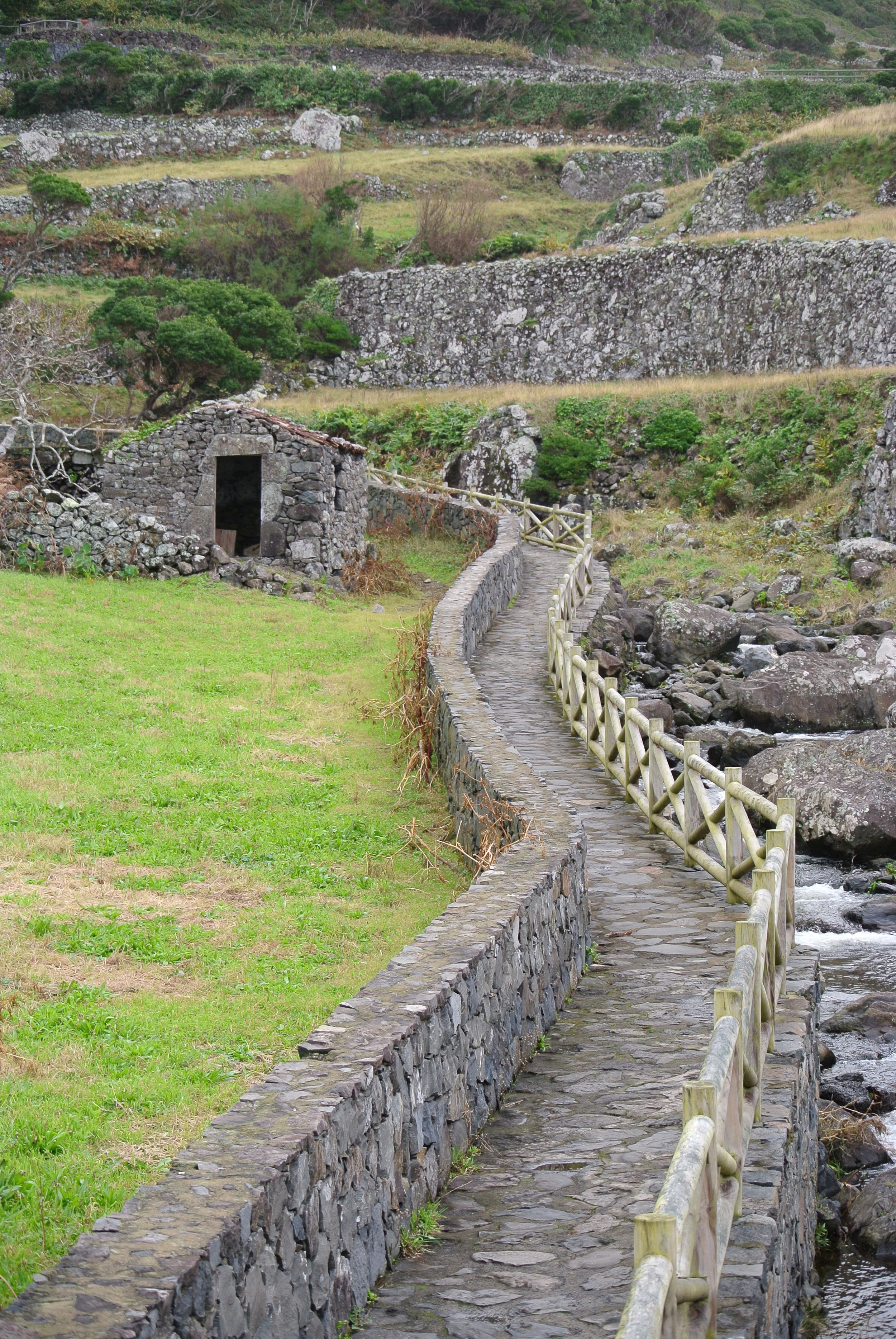
The island of Flores seems to have more cows than people, and the majority of the island seems to be covered by fields instead of buildings. In these fields, there are no roads, but instead neat little walkways. Some are stone, some are red volcanic pebbles, some are grass. They will work their way through the fields and along old field houses that are in varying levels of condition. 

IMG_3200.JPG

When you walk back through these fields, you will stumble across majestic views that your car could never reach! You will find streams, waterfalls, and forests that have grown around lakes that are deeper into the island. 

This one path follows a river up to the cliff where a thin and wispy waterfall coats the sides of the rocks with a thin mist.

Lava Breakwater

We spent a considerable amount of time in Terceira where all the breakwaters are man-made. Terceira is a rather old island, so the wind and waves have had about three million years to wear the volcanic rock away, thus necessitating the construction of man-made structures to protect the harbors and shores from the punishing onslaught of the waves. 

Flores, is about a million years younger than Terceira, and it shows! The volcanic rocks on the shore are very jagged and do just fine destroying the waves and dissipating their energy without the aid of mankind. 

FullSizeRender.jpg

Maddie and I often wonder if the locals look up at the magnificent cliffs and waterfalls as often as we do! To think that this view can be found right next to the public boat ramp!  

So much splendor in such a small space. 

Altered Reality

Camera phones are impressive machines. I came to the realization that my smart phone is the “do it all gadget” from older sci-fi movies. It has a flashlight, location information, maps, camera, voice recorder, video recorder, encyclopedia, and it can make phone calls too! 

The panoramic feature is fun to play with. It will compile a series of photographs into one long and wide photograph. Much like a multiple exposure photograph from the days of film cameras, the digital camera in the phone will stitch together multiple photos to create a panoramic image. But what if the image changes while the panoramic image is being taken? 

IMG_3869.JPG

It gives a pretty cool effect! Maddie started taking the panoramic image with me standing on the left, and as she panned right, I moved along for the show. It gives a pretty cool rendering of the future that we once invisioned we would be living. We don’t have flying cars or immortality, but we do have Batman’s utility belt in the palm of our hands.

Twin Lakes

These two lakes are actually the remnants of two volcanic craters that were responsible for forming this part of the island a few million years ago. The lake on the right is actually used as the water reservoir for the entire island.  

IMG_3849.JPG

During the rainy season, the lake will fill up and carry the entire water needs of the whole island through the dry season, when little rain falls to replenish the supply.  

These two lakes are considered a prime hiking destination, and listed on travel sites as a priority to see when visiting Flores. Then they go on to say that the only way to access the two lakes is via a 7km hike (one way, then you have to turn around and walk home)! I had heard that one of the lakes was a water reservoir, and knew there was no way that a government worker was going to hike 14 kilometers just to check on the lake. There had to be a road somewhere! 

So, we looked at the map and found that the lakes are located right next to a major highway on the island (which is a two way street with a dashed line down the middle of it) and that there was a small “service road” that forked off of the highway and led straight to the lakes. 

We went for a little drive and figured that we would at least be a lot closer to the lakes if we drove than if we started from miles away!  

Well, the service road ends in a parking lot that has some steps next to it. Maddie and I walked up the steps, maybe 100 meters, and this was the view! We could not believe that the trail ends at a parking lot, so we went exploring a little.

We found where the trail ends and began hiking it a little to see where the trail would go, and what the trail looked like. We snaked our way through a field and along the edge of the lake on the right, only to come out to the highway. Yes, the trail flanks the highway and at many points the trail “is” the highway. 

By driving to the lakes and skipping the 3 hour hike (one way), we were able to visit many more beautiful attractions and sights that this island has to offer. We did hike a little that day, but no where near the 14 kilometers that would have been required to get to these lakes, only to see a parking lot right next to the view we had worked so hard to see.