Cruising

Transatlantic: Day 26 [Day 47]

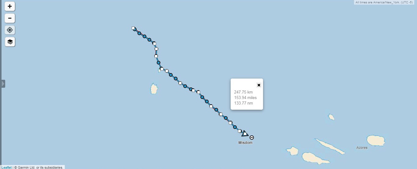
Yesterday, we saw land for the first time in 25 days. Then we kept on sailing and never stopped. Our destination lays a few hundred miles further east.

IMG-3370.jpg

As you can see, we chose to enter the south side of the island because the winds looked like they might start coming form the South. Yes, having a lee shore is not fun, but at the same time, fighting a wind shadow and then trying to short tack in a narrow straight is not fun either.

IMG_2597.PNG

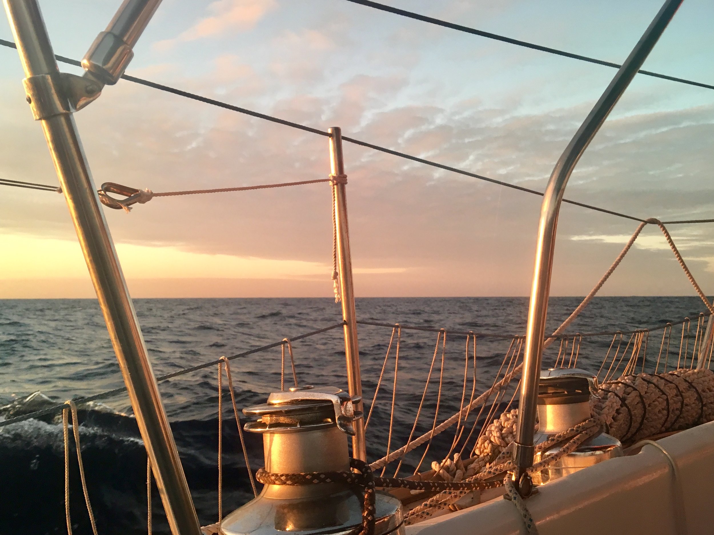
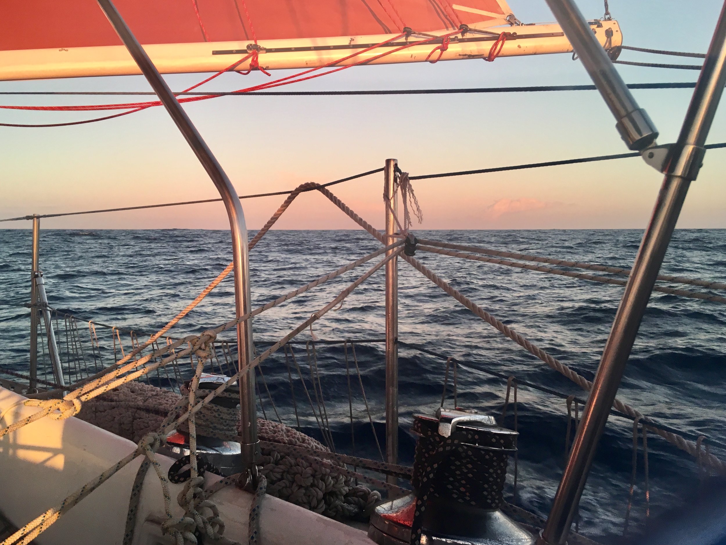
Over night, we had our best and fastest run ever! We averaged 6 knots and were doing over 8 knots for most of the night. This is wonderful because we were expecting to fly our light air sails that we had made for the Azores High. Instead, we were flying our regular sails with a reef in them. We were a bit overpowered and normally would have reefed down, but we needed to make all the miles we could while we had the wind. The next day was supposed to be very light winds and we wanted to make it to port before it got dark so we wouldn’t have to wait another night hove to outside of the harbor while we wait for dawn.

FullSizeRender.jpg

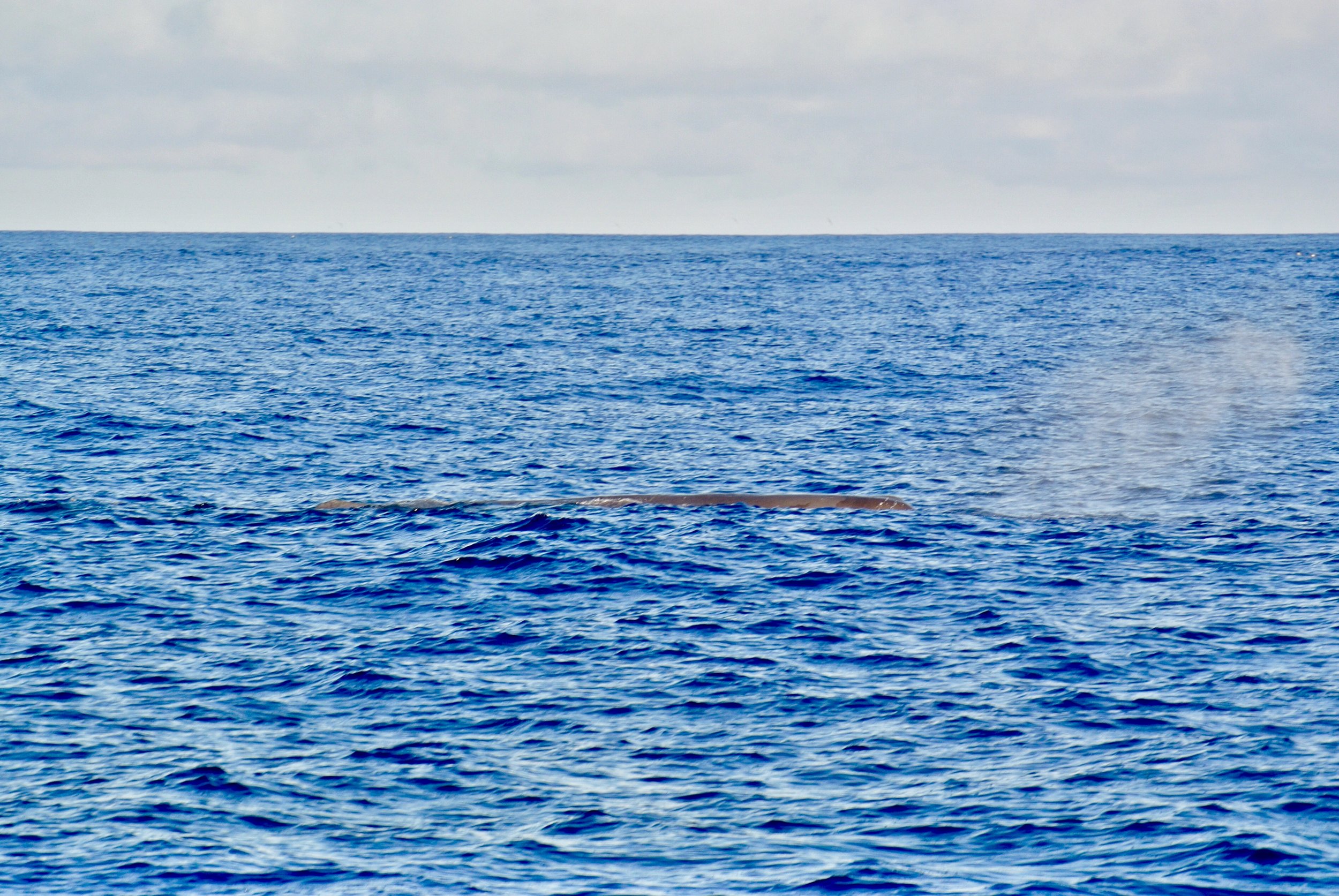
In the morning, we saw a sleeping sperm whale at the surface. The whale looked like a large flat log, only apparent when it exhales and creates a giant cloud of mist.

FullSizeRender.jpg

The distinct blow from a whale is easy to spot out on the distance which gave away their position in the times of whaling. Sperm whales were hunted with efficient strategies and hand launched harpoons from tiny boats all around these islands for hundreds of years.

FullSizeRender.jpg

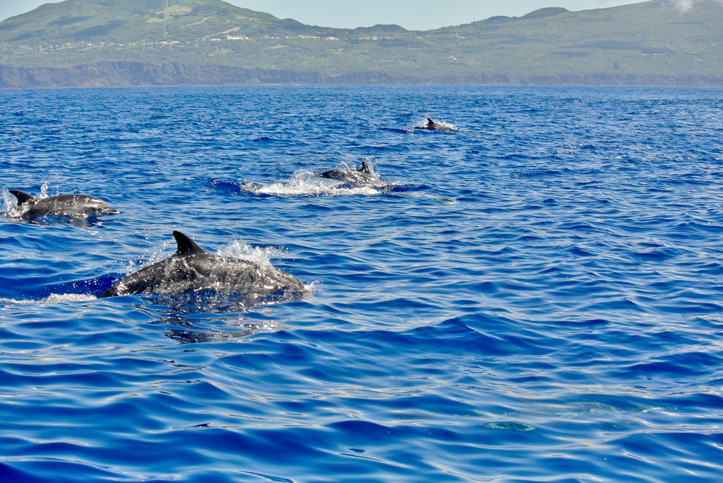
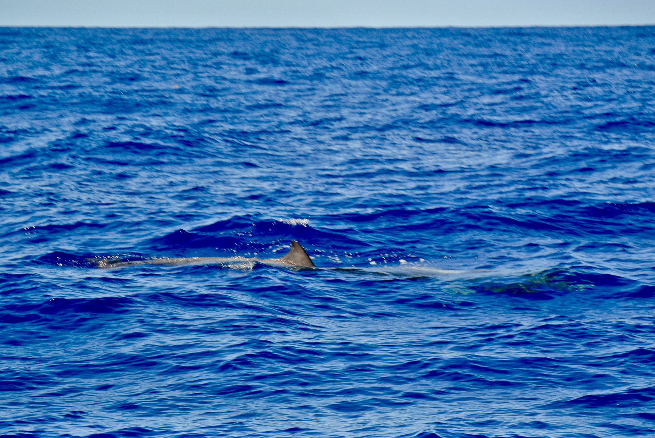
As we rounded the SW point of Faial, a pod of dolphins came out to greet us. This was a very magical moment and as tired as I was, I could not help myself but stare at them as they swarmed around our sailboat.

FullSizeRender.jpg

It almost felt surreal. The first island we passed, Corvo, has no civilization on the northern shore, so to us it just looked like an island with fields partitioned with hydrangeas. Faial on the other hand is a settled island with many cities that were established hundreds of years ago. Seeing the very European architecture from the water felt like being transported back to another time.

FullSizeRender.jpg

The highest point in Portugal, Pico, is visible just to the left of the leech of our jib. That massive volcano reaches up from the bottom of the ocean, some 4000 feet beneath the surface and then stretches up several thousand feet into the air. If you took away the water, Pico would be an epic mountain!

FullSizeRender.jpg

The sounthern shore of Faial is so quaint looking. There are fields and buildings, all with a similar architecture; terracotta roofs with white walls, all set on the hillside.

FullSizeRender.jpg

As we neared the harbor, we were presented with a massive volcanic creation that helps shield the harbor from the ocean waves.

FullSizeRender.jpg

After being isolated from civilization for so long, this is now what we get to gaze upon. This quaint little town. We never got this kind of a welcome in the United States. When you enter a harbor, the waters edge is lined with factories, or ugly boxy buildings. There is no style, no form, and certainly no aesthetic value put into the shorelines of the American ports. The towns do not display their beauty towards the water. American towns are pretty (some of them) once you are walking around them, but from the water, they look boring and plain.

This town showcases the style of buildings you can expect to find in the inter-lands of the island. More importantly, this town was designed to be approached from the sea and therefore the buildings are set to face the arriving boats. You can tell that the goal here was to make the town pleasant to greet arriving ships and their passengers.

FullSizeRender.jpg

After almost a year at anchor, mooring, or sea, we are now tied up to a cement quay. We have traveled a long ways and we feel like we have accomplished a great feat, but every other boat in this harbor has also crossed an ocean to get here! This is a port filled with true bluewater cruisers.

Transatlantic: Day 25 [Day 46]

Aug 1st, 2018. We have now entered the Azores, and with great speed too! Our average speed for this 24 hour run was a whopping 5.5 knots.

IMG-3369.jpg

At dawn the horizon was still empty, but I knew land would be visible soon. We decided to sail close to Corvo because we wanted to see some land before we made our way into the archipelago.

FullSizeRender.jpg

While the horizon might look like more water, there is a give-away written in the clouds! All clouds move, but clouds over an island will tend to be stationary.

While staring ahead, I noticed that the clouds just above and to the left of the gate never seemed to move. All the clouds were moving from right to left over the horizon, but those clouds were stationary. LAND!

FullSizeRender.jpg

We kept sailing in that direction and soon I could see the faint outline of the cliff sides of Corvo rising up out of the water!

FullSizeRender.jpg

A while later, we were several miles closer to the island and the outline of the landmass seems more pronounced on the horizon.

FullSizeRender.jpg

The original plan was to sail between Corvo and Flores as we entered the Azores, but I was worried about wind shifts from the cape effect as we passed through the narrow straight between the two islands. I was also concerned with the current that might exist in there as the tidal waters moved from East to West. According to the tide tables, it was supposed to be high tide, so we might be approaching the pass at peak ebb tide and be pushed back unnecessarily!

Instead of risking it, we simply put Corvo on our starboard bow and continued to make our way towards it.

FullSizeRender.jpg
FullSizeRender.jpg

We passed the island on the North side and stayed close enough to appreciate the beautiful sight of land but far enough to keep safe from the dangerous shores that we saw before us.

FullSizeRender.jpg

Passing the island on the North side while sailing on starboard tack means that we were not going to have a lee shore, but we would have to negotiate with the islands wind shadow. The wind shadow of an island can extend for miles, as it is roughly 8 times the length of the objects height. On a massively tall island like this, the wind shadow could easily extend for miles out to sea. Thankfully, the island is small so the wind shadow would be short lived as we drift across the waters while being pushed by the current.

FullSizeRender.jpg

As we neared, we were graced by the presence of something we hadn’t seen in a while: birds.

FullSizeRender.jpg

This guy looks like a brown albatross from a distance, though I am not a bird watcher by any measure. It was merely massive, huge, glided around without flapping its wings, and had a beak that resembles that of an albatross. Most importantly, this bird has land behind him!

IMG_4168.PNG

We have now entered the Azores and were close to our next port.

IMG_2594.PNG

We passed rather close to Corvo and once clear of the wind shadow, made our way towards Faial. Horta is located on the SE side of the island, but the winds were acting kind of fluky, so I decided it would be best to head straight there in as short a distance as possible. If we could get close to the island, we could then day sail our way into port without any major distances to cover. If we hedge our bets on what the winds will do, we might find ourselves far off with the wrong winds and no motoring ability to correct the mistake.

FullSizeRender.jpg

Seeing land after 25 days is magical. The horizon used to always be empty, and all of a sudden, there it is, the missing vision we have been searching for!

Transatlantic: Day 24 [Day 45]

The day has arrived, the day when we turn towards the Azores!

You might be wondering how we decided when to turn? Was it because Predict Wind said we should turn? Was it because someone told us to? Or was it because the clouds said it was time?

Well, a little of some and a lot of the others.

IMG-3367.jpg

Our Australian friends and our friend in the States both were away from their computers today, so we didn’t hear from anyone until late that night when they both told us that we should turn South towards Faial. At that point we had already turned!

What made me make the decision to turn? The clouds and the compass.

The weather was changing overhead and the high pressure was being pushed further to our stern, meaning that we would be able to turn without getting caught in the windless region of the high pressure system that was off our starboard side.

The compass was really the important one in this decision (as it should be). I knew the course we would be holding to get to Horta on Faial, and I decided that it would be best to sail a bit further East before turning so that we would be on a broad reach instead of a beam reach. Why? If I’m wrong about the winds on a broad reach, they will either be a run or a beam reach. If I’m wrong about the winds on a beam reach, they will either be a broad reach (which is fine) or a close reach (I hate beating)! I don’t want to run that risk!

So I simply sailed until the bearing to Horta was going to be a course on the compass that would have us on a broad reach with the low pressure that was coming in!

The other giant sign in the sky was the clouds literally turned at that point and basically lined a path that pointed straight towards Faial, the way they were blowing, it looked like a good track to be on and follow the weather system into the island chain!

IMG_4167.PNG

You can see here, we made it to around the area of our little sign post out in the ocean (on this digital map) and began turning towards the Azores! My, how far we have come!

FullSizeRender.jpg

The other good part about staying with the winds is it helps keep us charged up! Our batteries got a little low during that period of no wind that we had. We really like having fresh food on the boat, and to do that, we need to power the biggest most power hungry monster in our yacht: the fridge. This monster chugs the amps and just gives you the cold shoulder! Our house bank got a little low so we were supplying power to the fridge from the motor bank. That drained the motor bank down quite a bit though!

All this fast sailing we are having is great because our electric motor works as a hydrogenerator when sailing fast and that produces the power needed to charge the batteries back up!

Here, the display is saying that we are generating 6 amps at 48 volts. When you step that down to 12 volts (to power lights and the fridge) those 6 amps become 24 amps! That is some serious power it can generate and that is crucial because we will need power when we enter the marina and need to dock.

IMG_2637.PNG

Looking ahead at the information from Predict Wind, you can see that they are calling for the winds to be pretty good for the next few days, and then get kind of light. I don’t really care much for these kinds of charts because it all seems like guesses to me. I like when they are all agreeing, like they do for the first few days (because they are all working with good data) but then the radical spread occurs where one is calling for winds of 4 knots and another is calling for winds of 15 knots! All this tells me is that further out, no one knows and I should just ignore the computer programs and look to the sky to read the clouds.

Clouds tell you the weather you are having and going to have because they are generated by the very weather you are seeing and experiencing. I would much rather look to the sky for my weather than to look at a computer screen generated by a program written by someone who is guessing based on incomplete data.

Transatlantic: Second Week

Week two from Bermuda to the Azores, well, it’s actually 10 days because its a week of ocean time (you know, where time doesn’t matter), was a mix of everything!

First we had no wind and a nice break from all the fast sailing we had done. This gave us time to relax and celebrate my 31st birthday! Then the winds came back and we made our way East towards the Azores.

IMG-3356.jpg

We sailed about 707 miles in these 10 days, averaging 70 miles per day and a speed of 2.9 knots. I know that seems slow, but we actually bobbed around for about 4 days with no wind, and when the winds returned, they were still rather light.

IMG_2811.JPG

The light winds gave us the opportunity to appreciate the ocean in a way few do. Usually, calm conditions is when most cruisers crank on their engines and power their way through to the finish. Hull speed is easily achieved at a modest fuel consumption of around 2 gallons per hour. Cruisers have the fuel to burn and the intolerance for sitting still to justify the expense of the fuel, so off they go at full speed!

Us on the other hand do not have the ability to motor at hull speed for days. Instead, this is when we look out at the horizon and at the fish that are hiding in the shadow of our boats hull. We saw marlin and tuna swimming around our boat, as well as many Man-O-War.

FullSizeRender.jpg

These scary siphonophores are incredibly intricate! I had never before taken the time to notice the detailed pattern of their sail and how their balloon portion is slightly curved like a pastry and somewhat resembling a liver (with the different lobes making it larger on one side and pointy on the other).

FullSizeRender.jpg

We were also graced by the presence of many marine mammals. A whale came to check us out one day and surfaced close to us a few times before diving off into the distance and a massive pod of dolphins came to play with us when we were sailing along at speeds in excess of 6 knots.

IMG_2825.JPG

No matter the time of day, not even if I just came off watch and only want to sleep; the chance to see dolphins in the wild is always a worthwhile moment to be awake!

IMG_2822.JPG
IMG_4160.PNG

This week has also had some interesting neighbors which I identified on the satellite tracker interface. The skull and crossbones is Hurricane Chris, which we were avoiding, the windmill is the next waypoint we should head (according to our friends with Predict Wind), the boat is the position of our Australian friends who left Bermuda a few days before us, and then the islands of the Azores are marked with lighthouses and trees.

FullSizeRender.jpg

Aside from the marine friends we had encountered out there at sea, my second favorite part of this week (and any afternoon at sea actually) are the sunsets. Each is as unique as mathematically possible, and each more interesting than the last; except on cloudless days with an approaching low pressure system, those sunsets are rather boring.

We have been at sea with no sight of land for a long time and we have not seen another human since we left Bermuda, but oddly, we are doing great and enjoying each day at sea for what it has to offer.

Transatlantic: Day 23 [Day 44]

July 30, 2018 and we are nearing the Azores. The goal was to make it there in around 18 days, and at this point we are 5 days over that mark. This might seem like an issue to someone who is adhering to a strict schedule, but that is not us!

IMG-3366.jpg

The winds got a little light so we turned North a bit until they got stronger, then we continued sailing East towards the Azores.

IMG_4166.PNG

According to our friends who have now made it to Flores and our friends who are in the United States with weather routing programs on their computers, they have been telling us that the ideal turning waypoint is coming up. I plotted it on our screen with a sign post because I thought it was cute and it gave me something to do. I also added another lighthouse down on Ponta Delgada of Sao Miguel. Why? Because it is a harbor that I have studied and if we miss Horta, we can try for Angra, and if we miss Angra, we can try for Ponta Delgada. Why have so many backups? Because having backups means we don’t stress out if we miss our goal.

Imagine you are in a race and someone holds out a cup of water. It is a long race and this is the only cup of water that you will be offered to you. You are probably going to be really focused on that single cup of water. Everything else is unimportant and all your attention goes into reaching and obtaining that water.

That’s a lot of pressure to grab that single cup of water!

How about this situation for perspective: same race, but a long line of people holding out cups of water. If you miss one, simply re-aim for the next cup and grab that one. Easy!

That’s what I did here. I marked all the cups and created a long line of them for us to grab. We still have our ideal cup, but we can grab any of the other cups if we miss.

FullSizeRender.jpg

The clouds start talking today too. Up ahead on our starboard side, the sky is completely clear (high pressure).

FullSizeRender.jpg

To our Port side, you can see clouds rolling in (approaching low pressure).

FullSizeRender.jpg

Way out in the distance, directly to our Starboard beam, you can see reddish skies. This is very visible with polarized lenses, and tells you that you are looking at a high pressure system in the distance. The higher air pressure refracts light differently and shifts it towards the red side of the spectrum. Just by looking at it, you can see that there is a High to Starboard and you know that means no wind over there.

FullSizeRender.jpg

As the day continues on, the low from the Port side begins to roll in further and is now visible on the starboard side. This is how we make sure to stay in the wind. A low pressure system will have winds rotating in a counter clockwise manner, so being on the lower right side of the system means we will be having winds blowing from behind us! Basically, we can expect to be on a Broad Reach on Port Tack tomorrow (when the system comes in all the way), just by looking at the clouds!

FullSizeRender.jpg

As the day drags on, the low pressure continues to roll in. Low pressure systems are great because the winds come on gradually. This means that you don’t have to reef right away when you see them because you aren’t going to get smashed by a wall of wind in two days. Instead, the winds will simply continue to build gradually and you can go reefing accordingly.